Disasters evolve faster than traditional monitoring can track. Skylark Labs' adaptive AI drones provide real-time situational awareness that adjusts to changing conditions on the ground, replacing static monitoring with continuous intelligent assessment that keeps first responders safe and resources precisely deployed.
01Why traditional disaster response falls short.
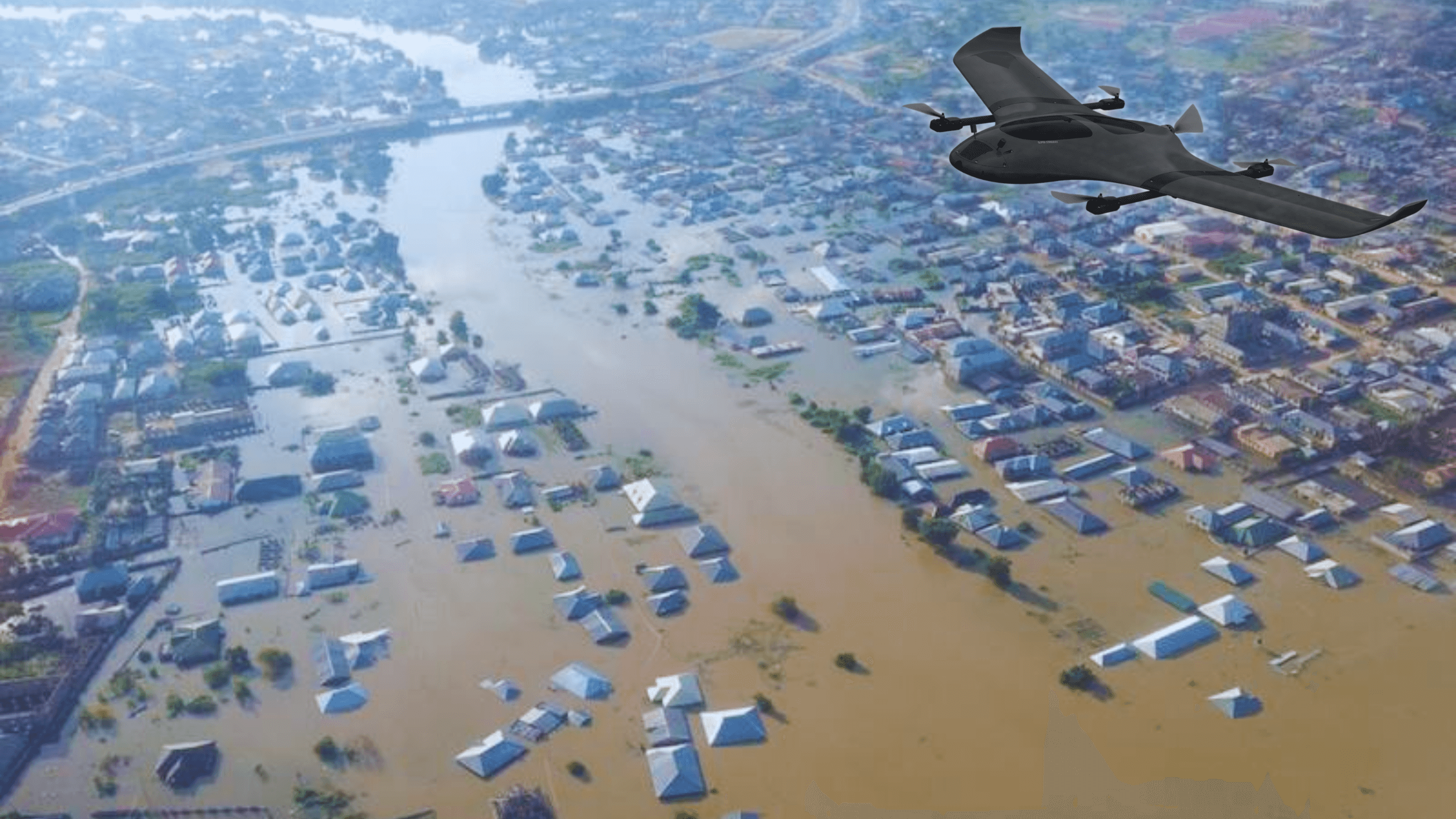
Hurricanes, floods, and wildfires change course unpredictably. Static monitoring systems cannot keep pace, resulting in delayed interventions and heightened risk to responders. Floodwaters and wildfire perimeters move constantly, making static resource plans obsolete within minutes. Smoke, fog, and darkness render conventional cameras ineffective, while manual assessment introduces critical delays when every second determines outcomes. According to research from AI in disaster management studies, response times can be cut dramatically when autonomous aerial platforms replace ground-based assessment.
The fundamental limitation of conventional disaster response is informational. Commanders must make life-and-death resource allocation decisions based on incomplete, outdated data. Ground-level reports arrive sporadically and cover only a fraction of the affected area. Satellite imagery, while useful for post-event analysis, lacks the resolution and update frequency needed for active incident management. The result is a reactive posture where emergency forces respond to where the disaster was, not where it is heading.
When a wildfire shifts direction in minutes, you need AI that adapts just as fast. That is what our drones deliver.Dr. Amarjot Singh — CEO of Skylark Labs
02How adaptive AI drones work.
Skylark Labs' drones continuously process multi-sensor data to update risk maps, redirect resources, and guide responders — all without human intervention. The system integrates Kepler's sensor fusion platform with edge AI processing to analyze electro-optical, thermal infrared, and LiDAR data simultaneously. When one modality is degraded — smoke obscuring visible light, rain disrupting thermal signatures — the system compensates by weighting the remaining channels, maintaining full situational awareness regardless of conditions.
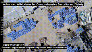
Live risk mapping is the core capability. The AI continuously tracks expanding floodwaters, wildfire paths, and structural damage, generating georeferenced threat assessments that update in real time. Every detection is automatically geotagged with GPS coordinates and timestamped, producing actionable intelligence products that integrate directly into emergency command systems.Highlight — rapid-deployment approach pioneered by leading emergency response programs
The drones predict high-risk zones and automatically direct personnel where they are needed most, replacing the slow cycle of manual reconnaissance with continuous, AI-driven resource optimization.
03Multi-hazard detection and responder safety.
Real-time alerts keep first responders out of danger zones. The AI identifies hazards that human observers would miss — structural weaknesses in flood-damaged buildings, toxic gas pockets near chemical spills, unstable terrain above landslide zones. These detections trigger automatic perimeter alerts that update as conditions change, creating a dynamic safety envelope around every deployed team. Similar multi-hazard detection capabilities are being validated in university research programs that convert drone footage into disaster response maps in minutes.
Force protection extends beyond hazard avoidance. The system tracks the location of every response team relative to identified threats, automatically rerouting personnel when conditions shift. If a wildfire front changes direction or floodwaters breach a new area, the AI recalculates safe corridors and pushes updated routing to field commanders before the threat materializes. This is a fundamental shift from reactive safety protocols to predictive, AI-driven protection that treats responder safety as a continuous optimization problem. Skylark Labs' Scout AI Tower can be deployed alongside drones to provide persistent ground-level monitoring of base camps and staging areas.
04Measured operational impact.
The shift from static monitoring to adaptive AI assessment delivers measurable improvements across every phase of disaster response. Real-time data enables immediate intervention when every second counts, with AI-driven prioritization eliminating wasted deployments to low-risk areas. Live hazard mapping reduces responder exposure to danger, while the same platform architecture adapts seamlessly across hurricanes, earthquakes, floods, and wildfires. The 2026 drone industry outlook confirms that AI-driven autonomy and beyond-visual-line-of-sight operations are rapidly becoming standard capabilities for emergency response.
Cross-disaster scalability is a critical advantage. Traditional emergency management systems require separate tools and workflows for different disaster types. Skylark Labs' Kepler platform provides a unified analytical framework that processes wildfire thermal signatures, flood boundary detection, earthquake structural assessment, and chemical hazard identification through the same onboard AI — reducing training requirements and ensuring that response teams can deploy the same technology regardless of the incident type. The Sentinel AI Camera further extends this capability by providing fixed-position monitoring of critical infrastructure during extended disaster recovery operations.
05The future of disaster intelligence.
Adaptive AI drones replace static monitoring with continuous, intelligent assessment. The result is faster response, safer operations, and better outcomes across every type of disaster scenario. As AI for Good research demonstrates, autonomous drones are transitioning from experimental tools to essential infrastructure for disaster preparedness. Skylark Labs is at the forefront of this transformation, building on the momentum of partnerships with leading drone manufacturers and public safety agencies to scale adaptive disaster intelligence worldwide.